Tags
#california, california, deathvalley, exotictravel, hiking, landscape, mountains, travel, trip
When I would think of Death Valley, I would envision endless, flat desert and, well, nothing else. Hence, you can imagine how pleasantly surprised I was when I vacationed there looking for big horn sheep and discovered there were waterfalls, color-streaked mountains, crazy landscapes, large moons, and gorgeous sand dunes!
First of all, you should know that Death Valley is a national park. If there’s anything I’ve learned since moving to California is that national parks are the coolest of cool places to visit. So, if you see someplace labeled as a national park, look no further, you are sure to see nature at its best.
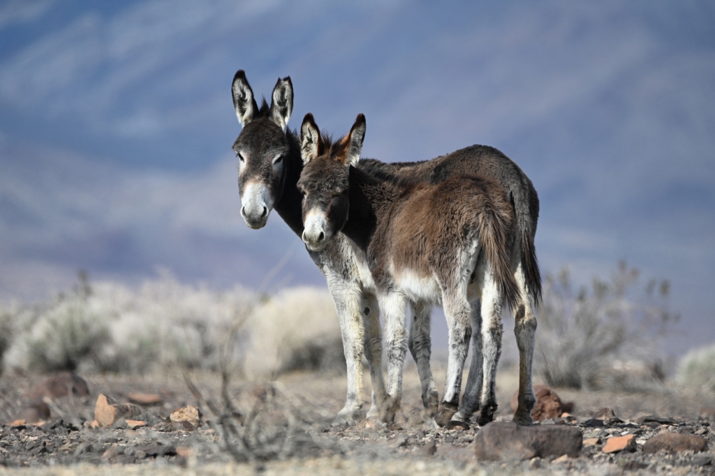
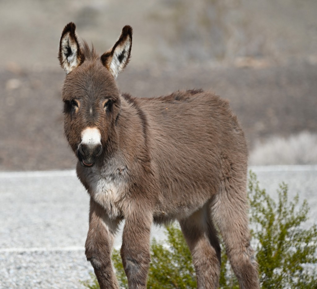
Perhaps my trip peaked early when, just before reaching the park, we encountered wild burros. Not native to the area, these animals are both survivors and reminders of California’s historic gold rush. When the prospectors left or switched to gas-powered vehicles, the burros were left behind. They now roam the lands, often taking handouts from tourists (that prevent both adults and babies from learning to properly forage for themselves) and being lured dangerously close to roadways.
We encountered two sweet mom/baby pairs and one bossy male. Did I mention baaaaabies? The babies were so cute in their winter coats that made them appear nearly as fluffy as baby sasquatches. Sasquatchi? Anyway, since I was excited to photograph wildlife, I was delighted to take a break with these animals that did not fear humans and even got dangerously close, hoping for a handout. One female spent a lot of time eyeing the contents of our car through the closed window, and part of me wondered if she was planning to kick it in if she viewed something that appealed to her. It was sad to think that the prospectors left behind not only ghost towns but, also, these non-native animals who had to learn to survive in a terrain without a lot of water or greenery. Mean ol’ miners.
The next thing you will view in the distance besides mountains are salt flats. For the entire trip, you will wonder if it’s water, due to the reflections, but, except for a few small spots, it’s dried salt beds. Trust me, I’ve done the legwork for you.
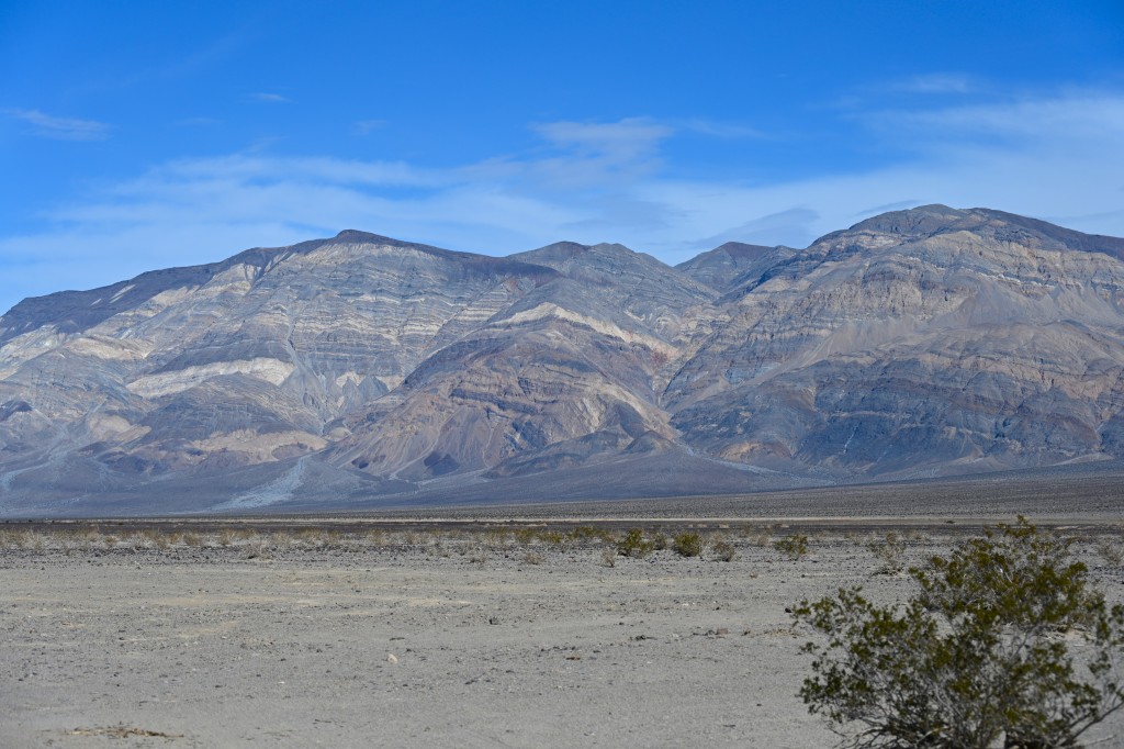
As you drive, you will see the mountains ahead made up of various colored layers that indicate the different types of minerals that can be found in the park. Iron, mica, and gold are a few.
Our first stop was a hike to Darwin Falls. It was a lucky time of year for the hike because, due to heavy rains this year, the falls were gushing. I was hoping to see big horn sheep getting a drink, but no such luck.
The next stop was an approximately four-mile hike up and down Mosaic Canyon. The canyon got its name from the outcroppings of sharp, tiny rock fragments locked into a natural cement. The pieces form a readily-identifiable mosaic that sits in sharp contrast to the incredibly smooth walls of dolomite. Because this is a slot canyon, it’s not the place you want to be during one of the flash floods that carved it and smoothed the shiny and slippery dolomite, so check the weather before you start the hike. I would rate this as a moderate hike, the most difficult part being that you frequently will need to climb up very slippery walls to finish the hike. It’s slippery, and it’s scary. Going back to your car, it’s all fun and games as you can literally slide down these walls on your bottom.
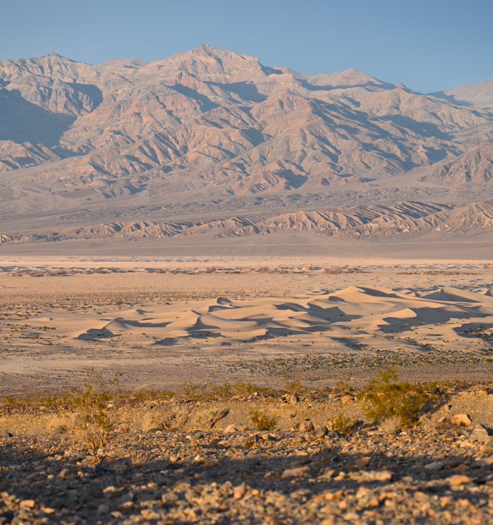
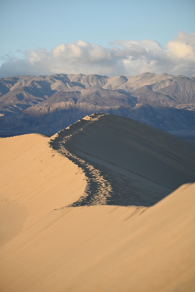
Leaving Mosaic Canyon, you have an excellent view of the valley below, including the dunes that provide a great difference in texture and lighting from the large mountains that sit beyond them. Stopping at the dunes below provides a great photo op and a nice place to watch the sunset’s reflection on the mountains.
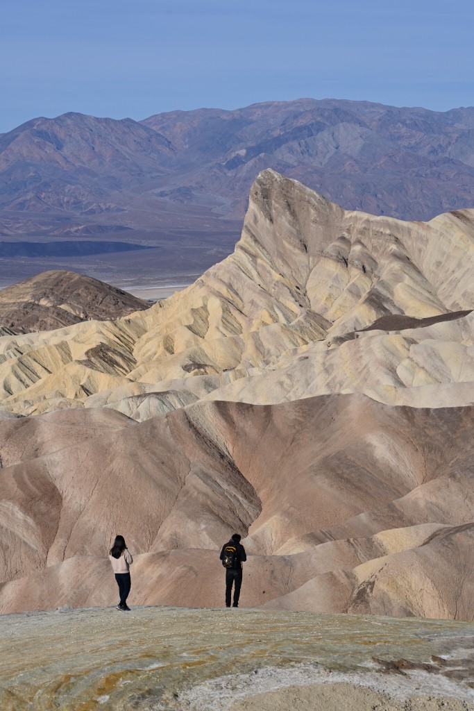
Trying to hit every open attraction Death Valley had to offer, Day 2 was busy. First, we hiked the Golden Canyon Trail that also led us to the Red Cathedral, Zabriskie Point, and a really cool mine that is now gated off, but you can look inside and see that there are two tunnels low enough to keep you from standing upright.
There are two ways you can hike this trail: One is leaving the parking lot and heading toward a large riverbed or wash and following it up the canyon. For all you Sci-Fi folks, I heard that portions of Star Wars were filmed here. The trail will loop around, and you’ll be able to see all of the attractions, but it’s the long route and, well, the Star Wars landscape got a little old after a few miles. I’d instead recommend skipping that part and just taking Golden Canyon to Red Cathedral (be sure to hike under the rocks on the Indiana-Jones-type trail versus going over), summiting at Zabriskie’s Point, and then going back. That portion of the trail is far prettier than the Star Wars portion. There is a lot of good scrambling to be found on this trail as well.
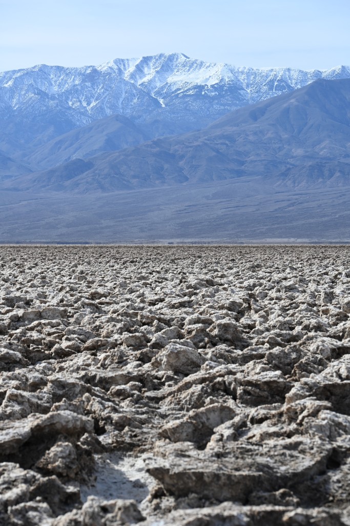
Then comes Devil’s Golf Course. This is a huge field of large salt chunks. It’s basically an ankle injury waiting to happen but, if you venture into the field and look very closely, you may be able to find some tiny, tubular salt formations that have not yet collapsed due to foot traffic. A snowy Telescope Peak in the background makes an excellent photo-op background.
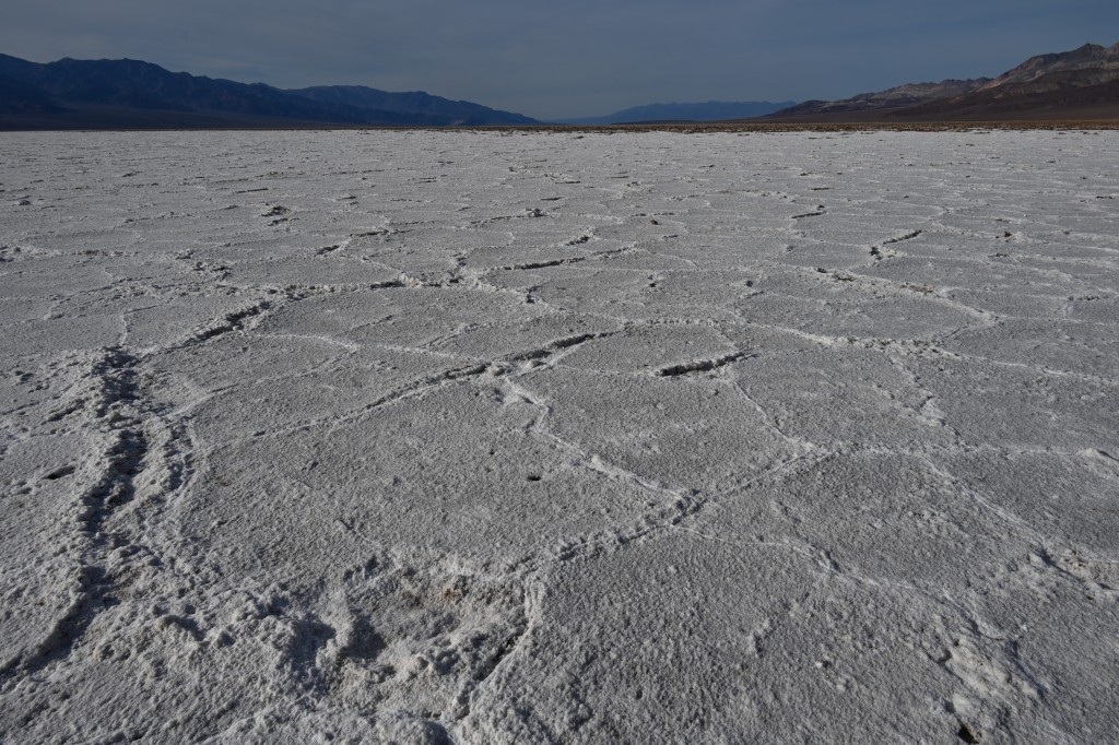
Mosey on down the road to the salt beds. This consists of a one-mile walk on a white road of salt. At the end you will find salt flats that extend as far as the eye can see in the form of octagonal shapes. Again, it’s a cool photo op. This spot happens to be 272 feet below sea level, and, despite runoff, it gets a little lower with every earthquake. As you walk back down the white road of salt, you can see a small sign on the cliff in front of you that reminds you how many feet below sea level you are. Interesting perspective. The last piece of trivia I have to share on this spot is that, in 1913, it hit 134 degrees, and it’s said that swallows were dropping from the sky. Poor birdies.
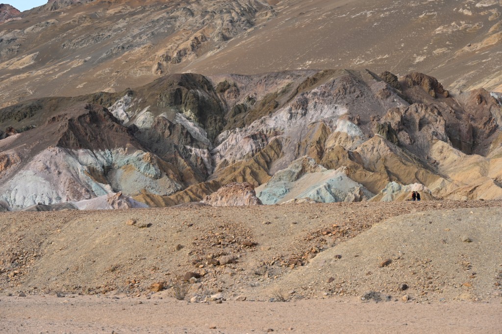
Heading back toward Stovepipe Wells, you come across Artist’s Pallet on your right. End of the day is a good time to stop here because you’ll get some nice sunset color illuminating the pinks, greens, purples, reds, and yellows. Each color represents a different kind of mineral. Kinda cool. You can hike through these colored hills, but, if you’ve already done everything we did on Day 2, you’ve probably hit the wall and can only focus on finding the nearest saloon. Yes, they really have at least one saloon in Death Valley, just like the wild, wild west. If I stumble upon a miner there, I’ll tell him to go feed his burros.
Day 3 is a good time to catch both sunrise and moonset on the dunes. Sounds like a great photo op, but there will be people out there at 6:45 a.m. spread around and appearing in every photo you try to take, so you’d better be good with Photo Shop if you want a non-people pic.
There is more to see in Death Valley proper, but it’s currently closed. I was especially bummed to miss The Racetrack. Its road won’t be open for at least a year due to heavy rains last summer. For those of you that don’t know, The Racetrack is where large rocks “mysteriously” move on their own accord, leaving behind very long trails in the desolate landscape. I was especially disappointed to not visit this photo op.
The other place we couldn’t visit was Scotty’s Castle. They had me at “castle.” Scotty’s Castle is named for gold prospector Walter Scott, although Scott never owned it, so that’s kinda weird. Spoiler alert: It’s not an actual castle. Just a two-story villa. Not that that’s anything at which to turn up your nose. We were told that this road is closed indefinitely. Like, years.
Having entered the park on the west side, we decided to take a different route home and left through the east side of the park, heading towards the Ash Meadows Wildlife Refuge. Multiple times on the drive we saw big horn sheep crossing signs, but did we see big horn sheep? Noooo. Ash Meadows boasts big horn sheep, so I was excited to check “big horn sheep” off my photo bucket list.
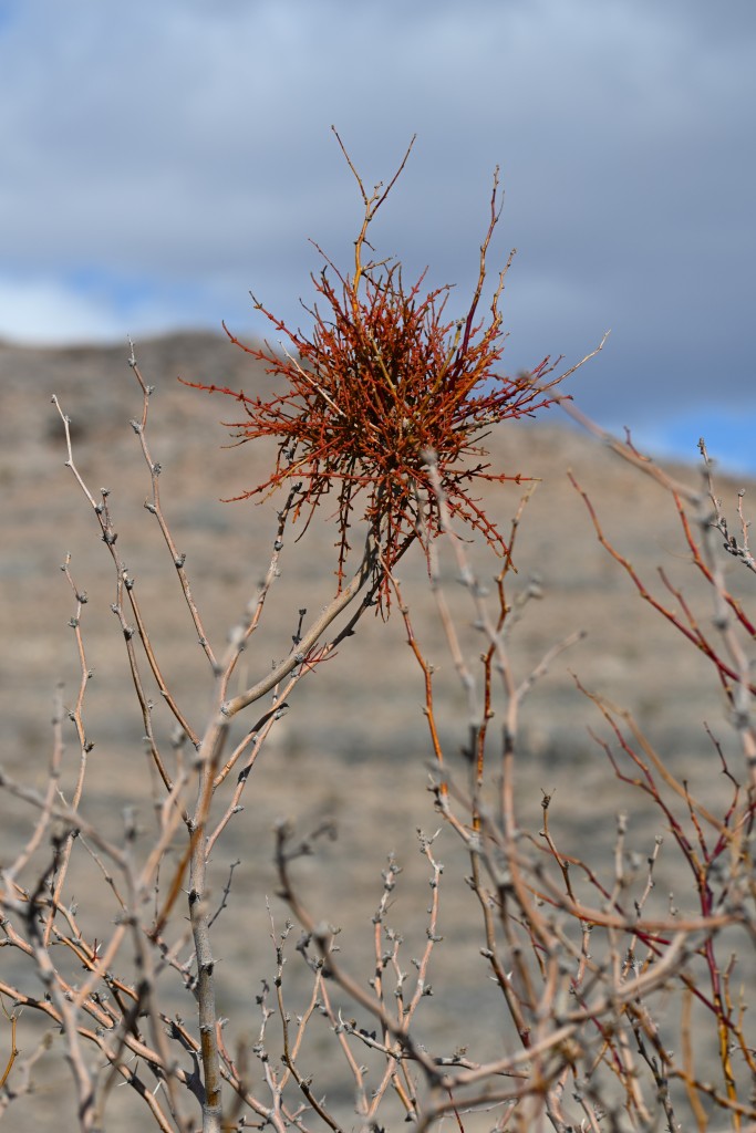
For those of you who don’t know, Ash Meadows is an oasis. Not a palm tree and green grass oasis, but, instead, a brown grass and burnt-appearing-trees oasis. Clumps of a kind of mistletoe adorn the trees. There are multiple springs, including Devil’s Hole (not all it’s knocked up to be) that bubble up 10,000-year-old rainfall from the earth.
The best spring to visit in the park is Point of Rocks. Here, you can walk on a boardwalk to this incredibly beautiful spring with the clearest water I’ve ever seen made up of vibrant blues and greens. This is the home to the endangered pupfish. They got their name because they frolic like puppies (I wasn’t seeing that), and they were the first animal to be placed on the endangered species list in 1967. These small, slightly larger than a guppy sized fish only live here in these springs. They’re bright blue and very pretty. One sign I read said there were only 200-400 of these tiny fish left, but there are a few different kinds of pupfish here, and I’m not sure if that’s all inclusive or just the fish in this spring. Maybe it was all inclusive because I felt like I was only seeing about 20 in this spring.
This spring was also to be the location where I was most likely to see big horn sheep. Did I see them? Nooo. Other than ravens, which I learned are different than crows (ravens have much larger beaks), a couple small birds and the burros were the only wildlife I saw on the trip. So no great wildlife shots, but there were some pretty cool landscape photos that I’ll share more of on my Facebook Kristie Dickinson author page.
The irony of Death Valley is that there is a very large water reservoir running under it. Maybe that’s from where the pupfish originate, or maybe there’s some underground world where the big horn sheep hang out during the day. Needless to say, I definitely “dug” Death Valley, but getting a big-horn-sheep photo op is still on my bucket list. The search will continue.
***
The Tunnels 2: Secrets completes the Harbor Secret Series. The first four books, The Tunnels, Devil’s Elbow, Leviathan, and Summerset are all available in audiobook format as well as paperback and ebook! Link below.
